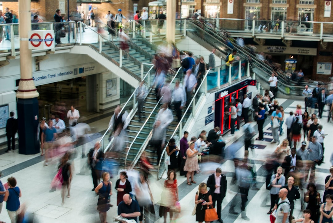
When a major storm crosses a shipping region, the biggest impact is often not the headline closure itself. It is the delayed container train, the backed-up interchange near the port, the flooded low point on a truck corridor, and the ferry terminal operating on a reduced schedule that turns a normal commute into a two-hour crawl. That is why freight corridor analysis matters to everyday travelers: it turns trade signals into a practical commute-delay forecast you can actually use. In the same way a traveler checks flight disruption potential before heading to the airport, commuters should check the storm vulnerability of nearby route-planning chokepoints that sit inside freight-heavy networks.
This guide translates GTAS-style forecasting into local commuter risk maps. We will show how to identify storm-vulnerable freight corridors, why post-storm freight congestion lingers long after roads reopen, and how highway, rail, and port impacts ripple into school runs, delivery windows, and end-of-day traffic. If you are trying to decide whether to take a freeway, rail-adjacent arterial, or ferry connection, use this as your field manual, and pair it with our practical guide on fast reroutes when travel systems fail and our checklist for packing for weather-volatile trips.
What a Freight Corridor Risk Map Actually Shows
It maps the movement system, not just the road surface
A true freight corridor risk map is not a simple flood map with a different label. It identifies where goods move at scale: interstate spines, port approaches, intermodal rail links, border crossings, river terminals, and ferry routes that connect islands or peninsulas to the mainland. Those corridors deserve special attention because even minor weather interruptions can cascade into long recovery periods once volumes surge back after a storm. In operations terms, the map blends physical vulnerability with network importance, which is why it is more predictive than a static hazard layer.
For commuters, that distinction is crucial. A bridge may be open, yet the adjacent ramp may be jammed because a warehouse district is catching up on missed deliveries. A rail line may be clear, but a nearby grade crossing may still be blocked by queued trucks or service vehicles. To understand how those bottlenecks evolve, it helps to think like a logistics planner and borrow the kind of intelligence used in trade forecasting systems and in broader market-analysis workflows.
Storm vulnerability is about exposure, elevation, and recovery time
The most useful risk maps combine three factors: how exposed a corridor is to wind, water, snow, or heat; how much traffic or cargo depends on it; and how quickly the system can recover after disruption. For example, a low-lying port access road may drain slowly after heavy rain, but the bigger problem is the 24 to 72 hours of backlog created when trucks are forced to queue or reroute. Similarly, a rail freight yard may survive the storm physically, yet high winds, signal outages, or power loss can delay dispatch schedules for a full shift cycle.
That is why commuter risk is often a second-order effect. Your route may not be the official target of the storm, but if it feeds an industrial park, a distribution center, or a container terminal, you inherit the congestion that follows the weather. The same thinking applies to people who plan daily logistics around time-sensitive constraints, much like readers considering local pickup and warehouse drop-off options to avoid delivery delays.
Why GTAS-style forecasts are valuable for local travel decisions
Trade forecasting platforms are built to anticipate flows, not just count trucks. That makes them uniquely useful during storm season because they can identify where freight is likely to surge once a corridor reopens. A commuter-facing version of that insight can flag the roads, rail lines, and terminal access points where traffic will worsen even after the rain stops. In practical terms, that helps you avoid the false assumption that a cleared weather radar means a cleared commute.
For travel planning, this is similar to watching how a route behaves during volatility rather than only at the moment of disruption. If you want a model for that mindset, see how planners use signal-based preparation in forecast signals that predict worse weather delays and how travelers handle severe reroutes in airspace shutdown scenarios.
How Storms Disrupt Freight Corridors After the Weather Clears
Backlog is the hidden hazard
The most underestimated phase of a storm is the recovery phase. Once visibility improves and road crews reopen a lane, freight demand often rebounds immediately. Carriers that waited out the storm rush to make up lost time, warehouses restart receiving windows, and ports clear vessel backlogs by pushing more trucks into the same access roads. The result is a congestion spike that can last longer than the storm itself. That spike is what commuter risk maps should emphasize, because it affects daily travel far beyond the emergency window.
In many metro areas, the post-storm pattern is predictable: the outer beltway clogs first, then the industrial arterial, then the bridge or tunnel feeding the port district. Rail-served logistics parks add another layer because drayage trucks arrive in waves timed to train unloads. A commuter who understands that sequence can reroute before the queue forms, instead of getting trapped in it.
Rail freight delays spill into road traffic
Rail freight does not just affect shippers; it changes street-level traffic. When a storm interrupts mainline service, freight gets held in yards, then released later in compressed windows. That creates unusual train crossings, slower switching activity, and concentrated truck movements near intermodal terminals. If you drive near those nodes, you may see traffic backups even when the highway itself has no storm damage.
This is especially important for commuters who rely on arterials that run parallel to rail corridors. If one route sits beside a container yard, grain terminal, or auto ramp, the corridor may remain slow for hours after the rain ends. For travelers who want a broader planning framework, our guide on keeping trips on track during disruptions offers a strong parallel to storm recovery travel.
Port impacts create regional ripple effects
Ports are among the most sensitive nodes in a freight corridor network because they connect land, sea, rail, and warehouse operations. A gusty harbor closure, storm surge warning, or high-water restriction can delay vessel loading and discharge, but the follow-on effects often hit commuters days later. Truck appointment systems get pushed back, off-dock container depots fill, and the surrounding freeway network absorbs the backlog. That means a bridge miles from the waterfront can still become a bottleneck because it sits on the port’s release path.
That same principle applies to ferry systems. A ferry cancellation may seem like a simple passenger issue, but on mixed-use routes it can choke island supply chains and force last-minute vehicle spillover onto adjacent roads. If your commute depends on a ferry, treat it like a freight corridor too, not just a passenger line.
Building a Commuter-Focused Freight Corridor Risk Map
Step 1: Identify the freight spine, not just your direct route
Start by tracing the infrastructure that feeds your commute. Look for nearby ports, intermodal yards, major warehouses, distribution parks, and rail spurs. Then identify which highways and surface streets carry that freight into and out of the node. The map is not just about the road you drive; it is about the surrounding system that can overload your road when weather hits.
To make this practical, list your regular route, then mark every segment within a few miles of freight-intensive activity. If your commute passes an industrial district, a river crossing used by trucks, or a rail underpass, that stretch deserves elevated storm vulnerability. This is the same type of risk logic used in system-surface-area analysis: the more connections a node has, the more ways it can fail.
Step 2: Score hazard exposure and reroute difficulty
Not every corridor is equally vulnerable. A riverfront expressway may face flood risk, but if it has strong parallel alternatives, the commuter impact may be modest. By contrast, a single bridge leading to a rail yard may become a severe choke point even in a relatively minor storm because reroute options are limited. A useful commuter score combines three questions: Is the route physically exposed? Is it freight-critical? And how many alternatives are available if traffic surges?
Use that score to assign categories such as low, moderate, high, and severe. Then revisit those categories after heavy rain, snow, or coastal wind events. If you live in a city with fast-changing conditions, you can reinforce this habit by checking our practical guide to forecast accuracy limits so you do not overtrust a single app display.
Step 3: Map the recovery window, not just the storm footprint
The key to real-world route planning is recovery time. A corridor that floods quickly but drains in two hours may be less disruptive than one that never floods but remains gridlocked for twelve hours because of freight replenishment. That is why commuter risk maps should include a “return to normal” estimate. In a port city, that window may stretch past the end of the weather event because vessel schedules, truck appointments, and rail slots all have to reset.
Think of the recovery window as the real commute hazard. If the storm moves out at dawn but the freight backlog peaks at 10 a.m., a midday commute may be worse than the pre-storm rush hour. Smart planning means watching the business system, not just the sky.
Highway, Rail, and Ferry Routes Most Likely to Cause Secondary Delays
Highways near ports and distribution centers
These roads are the first to jam after a storm because they absorb both local traffic and freight rerouting. Look especially at freeway ramps feeding container terminals, bypass highways around warehouse clusters, and beltways serving regional distribution hubs. If a storm forces one access point to close, the remaining ramps can be overwhelmed almost instantly. The congestion often looks like a normal traffic jam, but the underlying driver is freight displacement.
Commuters can reduce risk by identifying at least two alternative paths that do not intersect the same logistics complex. A route that appears longer on the map may actually be more reliable if it bypasses the freight choke points. For a broader approach to protecting travel plans, see our guide on trip readiness and capacity planning and the route-selection thinking in high-volatility route choices.
Rail freight corridors and grade crossings
Rail freight corridors become commuter hazards when they intersect roads at grade or when they attract concentrated truck traffic from nearby terminals. Storms can slow signaling, reduce speeds, and shift dispatch timing, which creates irregular vehicle queues at crossings and adds uncertainty to arrival times. Even when the line itself is operating, a cargo surge can spill into adjacent streets as carriers try to recover missed loads.
For neighborhoods near rail yards, the best indicator of commuter risk is often not the storm warning but the operational schedule afterward. Watch for train activity windows, terminal appointment backlogs, and power-outage recovery. If you frequently travel through rail-adjacent districts, it may be worth studying how disruption management works in other systems, such as warehouse pickup strategies and supply-crunch planning, because the same bottleneck logic applies.
Ferries and coastal connectors
Ferry routes are often overlooked in commuter risk maps, but they are extremely storm-sensitive. High winds, rough seas, lightning, and low visibility can cancel sailings, reduce frequency, or cause loading delays that ripple across both sides of the crossing. If those ferries carry freight as well as passengers, every canceled sailing effectively shifts load onto local roads and parking areas near the terminals.
This secondary effect matters even more in mixed-use coastal cities where ferry terminals are linked to warehouses, seafood processors, industrial parks, or island service routes. The commuter impact can be immediate: terminal queues, full parking facilities, and slower parallel road networks. If you commute by ferry, treat the terminal and its access roads as a single risk zone, not separate pieces.
Comparison Table: Corridor Type vs. Storm Vulnerability vs. Commute Impact
| Corridor Type | Primary Storm Risk | Typical Freight Effect | Commuter Impact | Best Avoidance Strategy |
|---|---|---|---|---|
| Port access highway | Flooding, wind, visibility | Truck backlog, appointment delays | Severe peak-hour congestion | Use inland parallel route |
| Intermodal rail corridor | Signal outages, fallen debris, power loss | Compressed rail releases, yard congestion | Crossing delays, side-street spillover | Avoid grade crossings near terminal hours |
| Ferry connector | Wind, waves, lightning | Schedule cuts, freight spillover | Terminal queues, parking overflow | Shift to bridge or inland transit option |
| Warehouse district arterial | Ponding, delivery bottlenecks | Inbound/outbound truck surges | Slow surface streets and turn lanes | Leave earlier or bypass logistics zone |
| River bridge freight route | Flood, high water, debris | Detours and load redistribution | Network-wide rerouting delays | Check upstream water conditions and backup crossings |
This table is the core of the commuter risk map. Notice how the most damaging situations are rarely the ones with total shutdowns. More often, they are the mixed cases: a route is technically open, but freight redistribution makes it functionally slow. That is why route planning during storm season should be based on corridor behavior, not just status labels.
How to Use a Freight Corridor Risk Map Before Leaving Home
Check storm timing against freight operating windows
The most useful commuter insight is timing. If you know when ports, terminals, and warehouses start their heavy cycles, you can avoid the hours when delayed freight re-enters the road network. Morning recovery often hits hardest after overnight storms, while late afternoon may deteriorate once outbound freight resumes. That makes the same road safe at one hour and unusable at another.
A practical routine is to compare weather timing, road status, and freight activity before departure. If a storm ended recently, assume the network is still “warming up” operationally. That simple mindset can save a commuter from arriving late because the road was technically clear but operationally unstable.
Watch for secondary impacts on schools, deliveries, and events
Freight congestion does not stay in the freight world. It affects school bus timing, grocery restocking, package delivery, and event staffing. If a port closure or rail delay pushes trucks onto local streets, side effects often appear in unexpected places: late arrivals at medical appointments, slow-moving carpool lanes, and more impatient traffic near commercial centers. The change may not show up as a formal closure, but it still damages the commute.
For people balancing family logistics with weather disruptions, the lesson is the same as in short-term rental planning or location-sensitive travel decisions: proximity to key infrastructure changes your risk profile. If you live near logistics corridors, build extra buffer time into any day with storm impacts.
Have a fallback route that avoids freight concentration
Your alternate route should not simply be “another road.” It should be a road that avoids the same freight node. If your primary corridor runs past a warehouse cluster, do not choose a detour that crosses the same industrial park from the other side. If your commute uses a bridge near the port, a backup that still funnels into port-bound traffic is not a real backup. Good route planning separates you from the freight pulse, not just the flooded lane.
For more on resilient planning under uncertainty, readers may also find value in recovery and readiness routines, because the best emergency commute decisions are made when you are rested, not rushed.
Pro Tips for Reading Storm-Vulnerable Freight Networks
Pro Tip: If a storm affects a port city, assume the worst congestion will often arrive after the rain stops, not during the rain itself. The freight system usually reactivates in waves, and that wave pattern creates the most severe commuter delays.
Pro Tip: In coastal and river cities, check both water conditions and truck corridor conditions. A bridge may reopen before the freight backlog clears, which means the route is technically available but still operationally risky.
Pro Tip: Treat rail crossings near terminals as delayed-impact zones. A line that looks clear on radar may still create street backups once yard activity restarts.
Why this Matters for Travelers, Not Just Logistics Teams
Weather disruption is now a network problem
Travelers and commuters are dealing with the same infrastructure pressures that logistics teams manage daily. A storm no longer affects only one road or one train line. It alters inventories, truck schedules, labor shifts, delivery windows, and passenger flows. That is why a corridor risk map is such a powerful tool: it shows the shared system behind the delay.
This is also why better forecasting matters. Accurate scenario planning helps you decide whether to leave early, switch routes, work remotely, or delay departure. As with any weather decision, no model is perfect, but a corridor-based risk map gives you a clear edge over generic weather apps that only show rain bands and wind speeds. For more context on forecast limitations, see why no app can guarantee perfect weather.
Freight visibility gives commuters an operational advantage
If you can predict where freight will surge, you can predict where traffic will worsen. That is the operational advantage of combining trade forecasting with local weather intelligence. It shifts you from reactive driving to proactive route selection. Instead of asking, “Is it raining on my route?” you ask, “Which corridor is about to absorb the recovery load?”
That small change in question changes the outcome. It gives commuters a better chance of arriving on time, lowers stress, and reduces the temptation to make last-minute risky maneuvers. In severe weather season, that is not a luxury; it is a safety measure.
FAQ: Freight Corridor Risk Maps and Storm Delays
How is a freight corridor risk map different from a regular weather map?
A regular weather map shows the hazard, such as rain, wind, or snow. A freight corridor risk map shows where that hazard will interact with critical logistics movement, including ports, highways, rail links, and ferry routes. The commuter value comes from identifying the secondary congestion that follows the storm, even after weather conditions improve.
Why do roads get worse after a storm ends?
Because freight systems restart in bursts. Once the storm passes, carriers, warehouses, rail operators, and ports all try to recover missed time at once. That creates a backlog that can overload nearby highways and surface streets long after the rain stops.
Which corridor types are usually most storm-vulnerable?
Port access highways, rail-adjacent arterials, ferry connectors, and roads serving warehouse districts are usually the most vulnerable. These corridors combine physical exposure with heavy freight dependency, which makes them prone to both direct damage and indirect congestion.
Can a commuter use freight data without being a logistics expert?
Yes. You do not need to manage shipments to benefit from freight intelligence. Start by identifying the major freight nodes near your route, then watch for weather events that could delay them. After a few storms, you will begin to recognize the recurring congestion patterns.
What is the best fallback route during storm recovery traffic?
The best fallback route avoids the same freight node as your primary route. A real backup should bypass port access roads, terminal perimeters, or warehouse concentrations rather than simply following a different street into the same bottleneck.
How far in advance should I check a corridor risk map?
Check it the night before, again before departure, and once more if the storm has recently passed. Recovery conditions change quickly, and the worst congestion may show up hours after the last rain band moves away.
Final Takeaway: Plan Around the Freight System, Not Just the Forecast
Storm vulnerability is not only a question of rain, wind, or snow. It is a question of how the freight system responds when weather disrupts the network. That is why corridor-based forecasting is so useful for commuters: it reveals the roads, rail links, ferry crossings, and port approaches most likely to create secondary delays. If you know where the freight pulse is strongest, you can avoid the routes most likely to fail under pressure.
For practical next steps, build your own risk map using the corridors you cross every week, then compare them against storm timing and freight recovery windows. If you need a broader framework for travel resilience, revisit our guides on fast reroutes, delay forecasting signals, and smart trip preparation. When weather and freight collide, the safest commute is the one that avoids the corridor most likely to absorb the storm’s aftermath.
Related Reading
- Why No App Can Guarantee Perfect Weather: Forecast Accuracy Explained for Hikers - Learn why forecast uncertainty matters when planning around storms.
- When Airspace Shuts Down: A Traveler’s Playbook for Fast Reroutes and Keeping Your Trip on Track - A practical rerouting guide for major disruptions.
- Find a Warehouse Near Me: Using Local Pickup, Lockers, and Drop-Offs to Speed Up Delivery - See how logistics hubs shape local traffic patterns.
- SEO & Merchandising During Supply Crunches: Content Tactics That Protect Rankings and Reduce Cancellations - A systems view of backlogs, shortages, and operational delays.
- Simplicity vs Surface Area: How to Evaluate an Agent Platform Before Committing - A useful lens for judging complex networks and hidden failure points.


